


Name: Amanohashidate
Address: Miyazu City, Kyoto Prefecture
Official Website: https://www.amanohashidate.jp/
Sightseeing and scenic viewpoints in Miyazu City, Kyoto Prefecture, connected by Amanohashidate, one of Japan’s three most scenic spots
Jul 21, 2025
829 views
Miyazu City, located in the northern part of Kyoto Prefecture, is a historic castle town famous for Amanohashidate, one of Japan’s three most scenic views. Positioned in the southwestern part of Wakasa Bay on the Sea of Japan, the area was once governed by various feudal lords, including the Hosokawa, Kyōgoku, and Honjō clans. Miyazu City, which is divided into north and south by the complex coastline and the neighboring Yosano Town, features a unique landscape connected by Amanohashidate, which resembles a bridge. Facing the Sea of Japan, Amanohashidate is counted among Japan’s three most beautiful views, along with Matsushima in the Tōhoku region, facing the Pacific Ocean, and Miyajima in the Chūgoku region, facing the Seto Inland Sea. In this guide, we will clearly introduce Amanohashidate, along with its breathtaking viewpoints, nearby sightseeing spots, and recommended attractions in Miyazu City.
table of contents
[x] close
Sightseeing and scenic viewpoints in Miyazu City, Kyoto Prefecture, connected by Amanohashidate, one of Japan’s three most scenic spots
1. Amanohashidate
◆ What is Amanohashidate like?
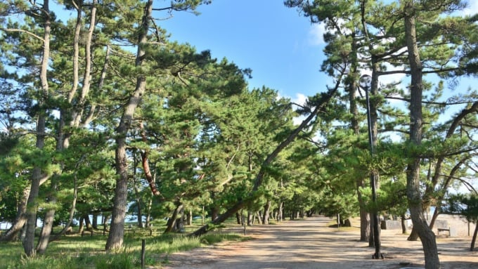
Amanohashidate is a naturally formed, slender sandbar stretching about 3.6 kilometers, appearing like a bridge over the sea. Over 8,000 pine trees are said to grow along it. This unique landform connects the Fuchu district on the north side and the Monju district on the south side with a pine tree-lined path. To the east lies Miyazu Bay, and to the west, the narrow inland sea called Aso Sea.
◆ Why is it called Amanohashidate?
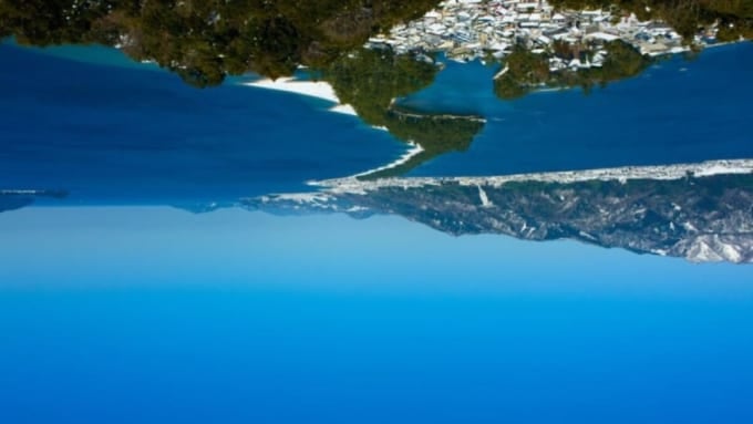
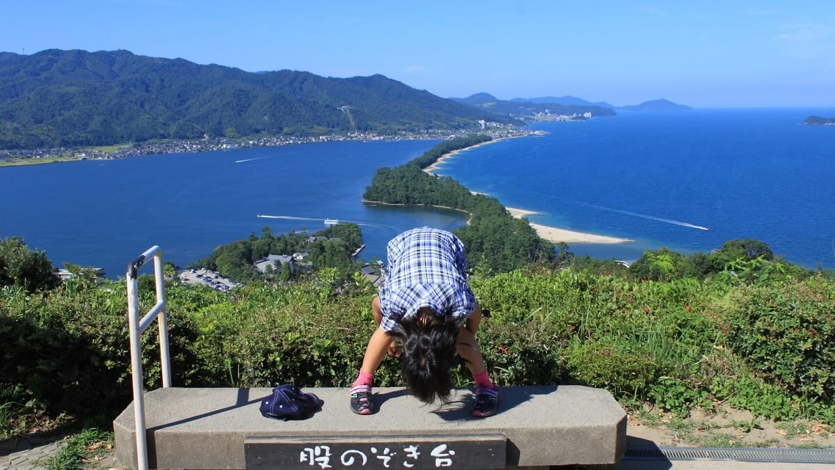
When you view Amanohashidate from the classic "Matanozoki" (looking between your legs) pose, the scenery appears upside down, making the sea look like the sky. This perspective makes the pine-covered sandbar appear like a bridge stretching to heaven, which is why it’s called "Amanohashidate" (meaning "Bridge to Heaven").
In Japan’s ancient texts like Kojiki and Nihon Shoki, it’s said that the god Izanagi stirred the ocean from the floating bridge of heaven to create the land. According to the Tango no Kuni Fudoki legend, Izanagi created a floating bridge as a link between heaven and earth, which later fell over and became Amanohashidate. Imagine this mythical world as you try the "Matanozoki" view for yourself!
◆ Let’s walk across Amanohashidate!
As one of Japan’s three most scenic views, Amanohashidate is a national park known for its beautiful white sand and green pine trees. It’s also designated as a Special Place of Scenic Beauty by the Japanese government. You might think you can't enter such a special site easily—but you actually can! Although it looks narrow, the widest part is about 170 meters across. Walking one way takes about 50 minutes, and cycling takes around 20 minutes. Cars are generally not allowed.
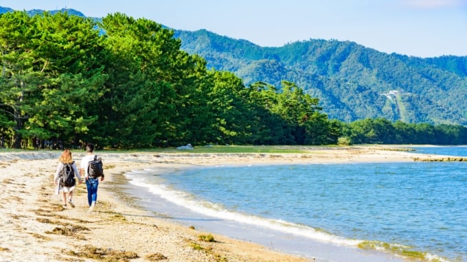
There are many attractions to enjoy along the way: Amanohashidate Shrine, a popular spiritual spot believed to grant love-related wishes; Isoshimizu, a freshwater well that contains no salt despite being near the sea; and stone monuments featuring poems by the famous literary couple Tekkan and Akiko Yosano. You can explore on foot or by cycling. On the east side of Amanohashidate, there’s a sandy beach, perfect for strolling along the shoreline.
◆ Is it true you can swim here, too?
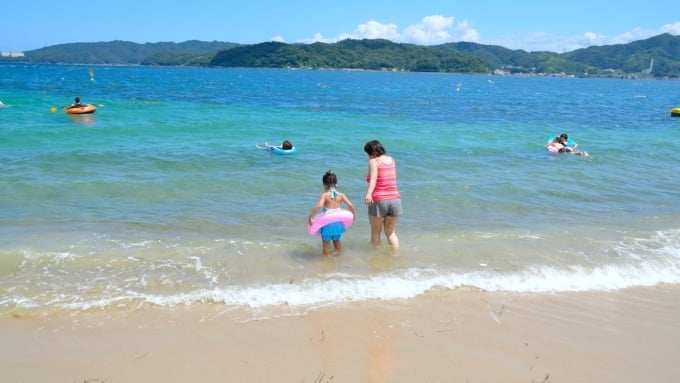
Yes! During summer, you can enjoy swimming at Amanohashidate’s beaches. To the north is Amanohashidate Fuchu Beach, and to the south is Amanohashidate Beach. The beaches officially open for swimming around mid-July each year. Facilities such as showers, restrooms, changing rooms, and seaside shops are available, and the area is bustling with people enjoying the sea.
2. Amanohashidate View Land
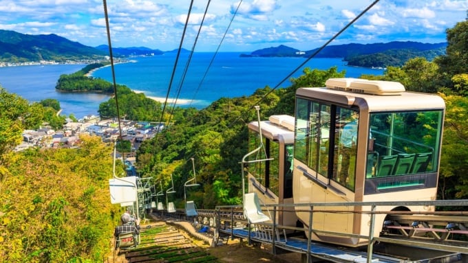
Amanohashidate View Land is a sightseeing spot located on top of Mt. Monju, offering a southern view of Amanohashidate. From this viewpoint, Amanohashidate looks like a "dragon descending from the heavens." However, if you do the traditional "Matanozoki" pose and look at it upside down, it transforms into the view of a dragon ascending to heaven, called "Flying Dragon View."
You can also enjoy a panoramic 360-degree view by walking along the Flying Dragon Corridor, designed with a dragon motif, and ride the cycle cars and Ferris wheel to take in the sights of Miyazu and Wakasa Bay. Amanohashidate View Land is conveniently located near Amanohashidate Station on the Kyoto Tango Railway. You can reach the summit by either monorail or chair lift.
Name: Amanohashidate View Land
Address: Monju, Miyazu City, Kyoto Prefecture
Official Website: https://www.viewland.jp/
3. Kaisen Bridge
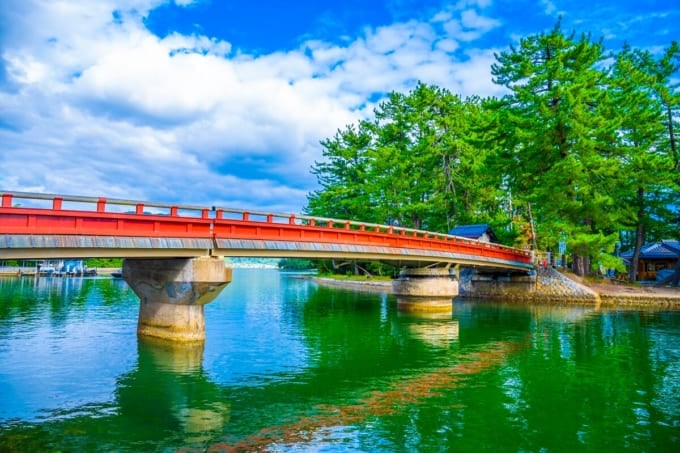
Earlier, we mentioned how Amanohashidate connects the north and south lands like a bridge. However, technically, the south side isn’t fully connected to the mainland. Instead, it’s linked to the southern Monju district via an island called "Kobashidate," which stretches east to west.
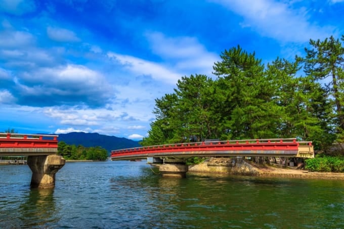
One highlight here is the "Kaisen Bridge," which connects Monju district and Kobashidate. This bridge is unique because it rotates 90 degrees to allow boats to pass. It’s so interesting that it was even featured on NHK Educational TV’s PythagoraSwitch.
The area between Monju district and Kobashidate looks like a canal. When sightseeing boats or large ships pass, the bridge turns electrically so they can get through. Since the bridge rotates slowly, sometimes tourists stay on it while it’s turning!
Name: Kaisen Bridge
Address: Monju, Miyazu City, Kyoto Prefecture
Official Site: https://goo.gl/SUZAEK
4. Kasamatsu Park
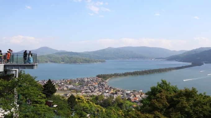
On the north side of Amanohashidate lies Kasamatsu Park, said to be the birthplace of the "Matanozoki" pose. From here, Amanohashidate looks like a straight line, a view known as "Diagonal Bridge." You can reach Kasamatsu Park by taking the cable car or lift up to about the third station on Mt. Nariai, which stands 569 meters above sea level.
The park features two observation decks and a "Matanozoki" platform. Try your luck with the "Kawarake Nage" game, where you throw clay discs through a ring for good fortune! At the AmaTerrace facility, you can enjoy meals while overlooking Amanohashidate and Wakasa Bay, and shop for souvenirs.
A "Two Major Amanohashidate Viewpoints Ticket" combines round-trip rides to both Kasamatsu Park and Amanohashidate View Land for a good deal. If you’re visiting Amanohashidate, make sure to enjoy the views from both the north and south sides!
Name: Kasamatsu Park
Address: 75 Ogaki, Miyazu City, Kyoto Prefecture
Official Website: https://www.amano-hashidate.com/
5. Nariai-ji Temple on Mt. Nariai
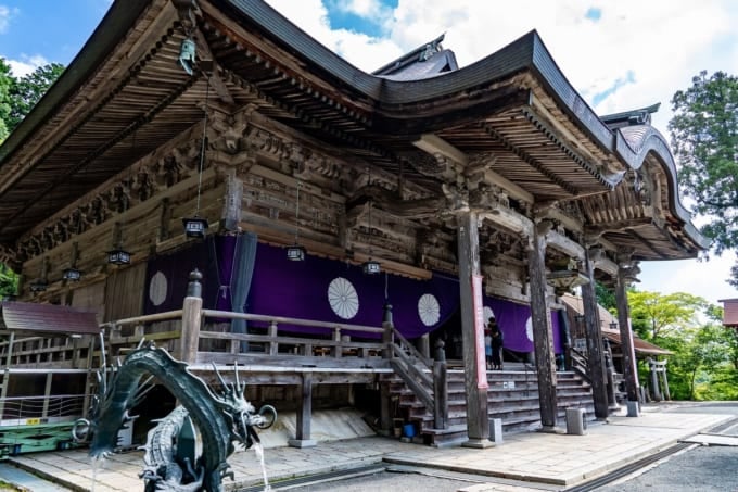
Nariai-ji Temple, said to grant wishes, is located further up from Kasamatsu Park at about 350 meters above sea level. This temple is the 28th temple of the Saigoku Pilgrimage and the northernmost temple on the route. It has a traditional main hall, a statue of the Substitution Kannon, and a five-story pagoda. It’s also known for legends like the sad "Silent Bell" and the mysterious "Bottomless Pond."
While it’s a sacred training site for mountain ascetic practices, Nariai-ji is also famous for its breathtaking views of Amanohashidate. From Benten Mountain Observatory within the temple grounds, you can see all of Amanohashidate. If you drive a little higher up to the Panorama Observatory, you can see all the way to Noto Peninsula! You can drive directly to the temple from the bottom of the mountain as well.
Name: Nariai-ji Temple, Shingon Buddhism, Mt. Nariai
Address: 339 Nariaiji, Miyazu City, Kyoto Prefecture
Official Website: https://www.nariaiji.jp/
◎ Summary of Amanohashidate, One of Japan’s Three Scenic Views
If you’re touring Amanohashidate’s pine tree path, renting a bicycle is the most efficient way to explore. You can combine bike rentals with sightseeing cruises or motorboats, and there are many package tickets available. Don’t miss the Chie-no-Wa Lantern and a visit to Chion-ji Temple, one of Japan’s three great Monju temples. Right next to Amanohashidate Station, you’ll find Amanohashidate Onsen, "Chie-no-Yu," where you can refresh yourself in the skin-beautifying hot springs and relax after a day of sightseeing.
RELATED ARTICLES


REGIONS
CATEGORIES
FEATURED ON Kyoto
-

[Kansai] What kind of hotels are ideal for “Hocance”? | Introducing 7 recommended picks
-

Top 10 Stylish Starbucks Stores in Japan – Scenic Views & Beautiful Designs!
-
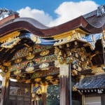
Nijō Castle (former imperial Villa Nijō Castle) sightseeing | The stage of the Edo Shogunate’s birth and the return of political power
-
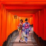
【Kyoto】What is Fushimi Inari Taisha? Complete guide to the Senbon Torii and highlights
-
Kizugawa: Once an Imperial Capital – 5 Historical and Nature Spots to Discover
MOST POPULAR ON Kyoto
-
 1
1Doha: Must-see Attractions in the Capital of Qatar
-
 2
2Toronto: 10 Things to do in this Picturesque Canadian City
-
 3
3Amarillo: A City Famous for It’s Amazing Canyons, Great History and Music
-
 4
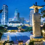
4South Korea: Dazzling Scenery, Rich Culture and Fascinating History
-
 5
5Kuwait: A Country in Middle East Asia Famous for Hot Sand Dunes and Stunning Cityscape