


Name: Okoshiki Coast Observation Deck
Address: Toguchi-machi, Uto City, Kumamoto Prefecture 869-3174
The Beautiful Shoreline of Uto Peninsula! “Okoshiki Coast” and Nearby Tourist Spots
Oct 8, 2025
692 views
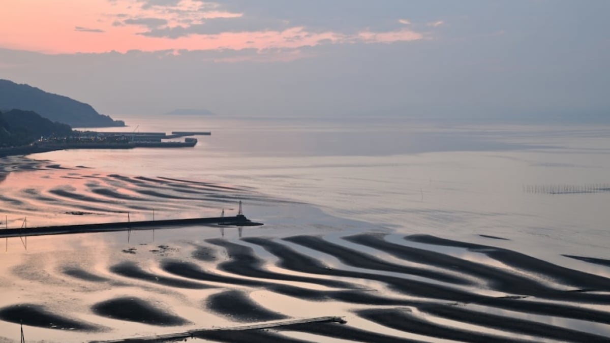
The Okoshiki Coast is located on the northern shore of the Uto Peninsula in Kumamoto Prefecture.
According to legend, during Emperor Keikō’s expedition to Kyushu in ancient times, he was so captivated by the beauty of this coastline that he ordered his palanquin (mikoshi) to stop so he could admire the view. From this story, the coast came to be called “Okoshiki” (meaning “where the palanquin stopped”). This stunning scenic spot, a source of pride for Kumamoto, has been selected as one of the “100 Best Beaches in Japan” and “100 Best Sunset Spots in Japan.”
One of its most striking features is the magnificent, curving ripple patterns in the sand that appear after the tide recedes. This mysterious shoreline, created entirely by nature, captures the hearts of all who see it. Here, we will introduce the beautiful Okoshiki Coast and its surrounding tourist attractions.
table of contents
[x] close
The Beautiful Shoreline of Uto Peninsula! “Okoshiki Coast” and Nearby Tourist Spots
Getting to Okoshiki Coast
Access to Okoshiki Coast is easiest by train or car.
If traveling by train, take the train from Kumamoto Station to Uto Station, then transfer to the Misumi Line and get off at Oda Station. From Oda Station, it’s about a 20-minute walk to the coast. Be aware that trains run only about once an hour, so plan your schedule carefully to avoid long waits.
If coming by car, exit the Kyushu Expressway at Matsubase IC, then take National Route 218 to National Route 3, which leads into central Uto after about 10 km. From there, follow National Route 57 west for just under 10 km to reach the northern shore of the Uto Peninsula, where Okoshiki Coast is located. The parking lot holds about 20 cars, but on days when the tide and sunset timing are ideal, it often fills up shortly after noon. Parking is free.
Spectacular Sunsets
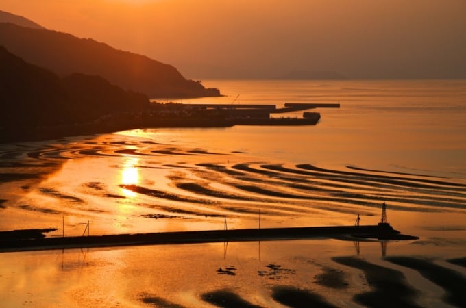
At Okoshiki Coast, the sight of low tide overlapping with the setting sun is truly magical, drawing many visitors who seek this view. This scene occurs only a few days a year, making it a dream photo spot for photography enthusiasts. Unfortunately, it’s not something you can see at any time—it requires the perfect alignment of clear weather, low tide, and sunset.
The large tidal range of the Ariake Sea creates these natural “sand art” patterns. As the tide begins to recede, waves and wind trace beautiful curves across the tidal flats. At sunset, the crescent-shaped curves glow orange; during twilight, they take on a soft purple; in bright daylight, they shine silver; and under a full moon, they glisten gold.
A viewing platform has been built on a hill overlooking the coast, complete with restrooms and parking, making it an excellent spot to aim for when visiting.
The Dreamlike “Nagabeta Kaishoro” at High Tide
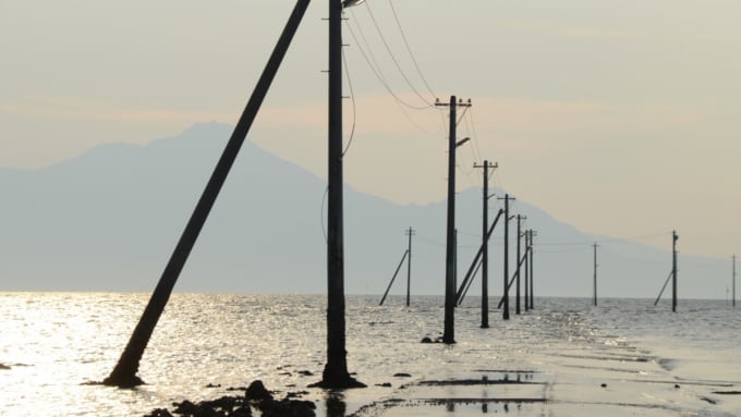
Nagabeta Kaishoro evokes scenes from Spirited Away. Its mystical view resembles the ocean scene where Chihiro rides the train with No-Face. At high tide, the road is submerged, creating a surreal sight. The line of streetlights shining across the water makes it feel as if you’ve wandered into another world. From here, the view of Mount Unzen-Fugendake across the Ariake Sea is breathtaking.
Photos of the concrete road appearing to run across the sea are often used to introduce Nagabeta Kaishoro. However, to witness this scene yourself, you’ll need good weather and a check of the tide tables. The sight of the road running through the sea at sunset is a must-see, but it appears only for a brief moment when weather, tide, and timing all align—a truly rare experience. Seeing it in person will leave you with a lifelong memory.
Name: Nagabeta Kaishoro
Address: 3125-1 Sumiyoshi-machi, Uto City, Kumamoto Prefecture 869-0401
Sumiyoshi Shrine and Taware Island
Taware Island is an uninhabited rocky islet floating in the Ariake Sea off Sumiyoshi-machi, Uto City. At its peak stands a torii gate inscribed with “Sumiyoshi Shrine.” Despite its small size, this island is mentioned in classical works such as The Pillow Book and The Tales of Ise. The reason it became so well-known was that, in the days when ships were the main means of transport, it served as a landmark for vessels entering Kumamoto.
Sumiyoshi Shrine itself is located atop a hill in Sumiyoshi Natural Park and is revered as a guardian deity of maritime routes. During the rainy season, hydrangeas planted around the mountain bloom in full splendor, making it one of Kumamoto’s top hydrangea viewing spots. The park also features Japan’s oldest lighthouse. Parking is available, but only for about three cars.
Name: Sumiyoshi Shrine
Address: 2067 Sumiyoshi-machi, Uto City, Kumamoto Prefecture 869-0401
Can You Crawl Through? The Mini Torii of Awashima Shrine
Affectionately known as Awashima-san by locals, Awashima Shrine is said to bring blessings particularly for leg and back health. According to tradition, crawling through the three mini torii gates on the grounds (each about 30 cm tall) grants blessings for safe childbirth, fertility, and good health. For those attempting this, straw mats are laid out to make it easier—though wearing a skirt might be tricky, so comfortable pants are recommended. These adorable mini torii make for a memorable travel photo.
Name: Awashima Shrine
Address: 557 Shinkai-machi, Uto City, Kumamoto Prefecture 869-0403
Official Website: https://www.awashima.or.jp/top.htm
Roadside Station Uto Marina
Roadside Station Uto Marina is a rare combination of a roadside station and a “sea station” located along National Route 57. Adjacent to Okoshiki Coast, it offers excellent views of Mount Unzen-Fugendake, making it a prime scenic spot. Inside, fresh seafood, vegetables, and fruits are sold at reasonable prices, and there’s a seafood restaurant where you can enjoy the local catch. The restaurant opens at 11:00, so plan accordingly. Note that Uto Marina has regular closing days, so it’s best to check in advance.
Name: Roadside Station Uto Marina
Address: 3084-1 Shimo-oda-machi, Uto City, Kumamoto Prefecture 869-3173
Official Website: http://okoshikikan.net/
◎ Gateway to the Amakusa Islands
The Uto Peninsula lies in central Kumamoto Prefecture. National Route 57 ends at Misumi Bay on the tip of the peninsula, which serves as the gateway to the Amakusa Islands. With connections to the JR Kagoshima Main Line’s Misumi Line, transportation access is excellent.
National Route 57 leads to the Amakusa Pearl Line, which crosses the sea via the five bridges known as the Amakusa Gokyō, offering views of numerous islands of varying sizes. Along Route 57, you’ll also find scenic spots like Okoshiki Coast, historic shrines, and roadside stations. As the entrance to the Amakusa Islands, it’s well worth a stop to enjoy the beautiful scenery.
RELATED ARTICLES


REGIONS
CATEGORIES
FEATURED ON Kumamoto
-
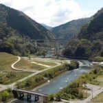
Reviving the Ancient Mountain Castle! Introducing the Kikuchi Castle Ruins, a Tourist Spot in Kikuchi City, Kumamoto Prefecture
-
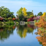
Classic Sightseeing Spot in Kumamoto City! Highlights, Souvenirs, and Sweets of Suizenji Jojuen Garden
-
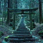
[Kumamoto/Takamori Town] What is Kamishikimi Kumanoimasu Shrine? | A Mysterious Legend and the Setting of an Anime
-
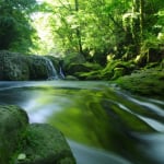
Not Just Aso! Introducing the Scenic Spot of Clear Waters and Deep Valleys: “Kikuchi Gorge”
-
12 Must-Visit Tourist Spots in Itsuki Village – The Home of Lullabies!
MOST POPULAR ON Kumamoto
-
 1
1Doha: Must-see Attractions in the Capital of Qatar
-
 2
2Toronto: 10 Things to do in this Picturesque Canadian City
-
 3
3Amarillo: A City Famous for It’s Amazing Canyons, Great History and Music
-
 4
4South Korea: Dazzling Scenery, Rich Culture and Fascinating History
-
 5
5Kuwait: A Country in Middle East Asia Famous for Hot Sand Dunes and Stunning Cityscape